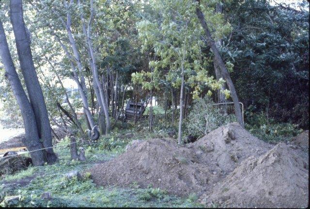
Cottage Park Shoreline "Sediment" Removal (1982)
Before and during the development of the 1983 Cottage Park Homeowners' Easement, there was a plan developed for the easement and how docks and the swimming area were going to be arranged.
There were jurisdictional problems with the original plan. See the "DNR and WBLCD" section for more information.
Cottage Park Shoreline "Sediment" Removal (1982)
Docks: Lake Level 923 ft (2017)
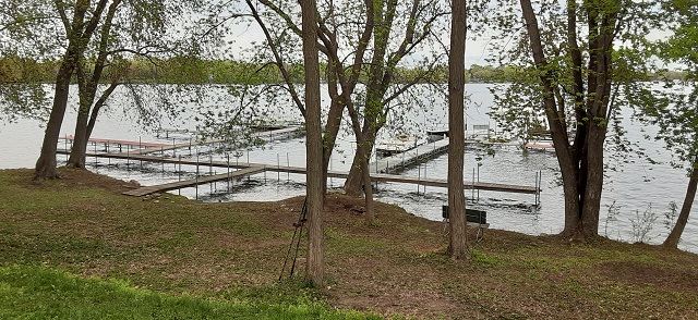
Closest Dock Off Nature Preserve
The original plan was for the Cottage Park Homeowners' Association to own the "Park A" land. After it was determined that the City of White Bear Lake owned the property, the City agreed to allow the Homeowners to have an easement over part of the property. The easement was to be called the Cottage Park Homeowners' Easement. The remainder of the property would be the Cottage Park Nature Preserve and the Cottage Park Pedestrian Walkway.
Originally, the easement was going to be on the westerly portion and the preserve was going to be on the easterly portion. The homeowner adjacent to the easterly portion insisted that the preserve was needed to act as a buffer between their property and the easement.
After some investigation by the City and some homeowners, it was determined that operating boats and docks from the westerly portion of the property was not feasible. It was concluded that the easement should be on the easterly portion.
Then the boundaries of the easement had to be determined. The easterly boundary coincided with the adjacent lot. It was suggested that a minimum shoreline be established for docks. It was approximately 150 feet from the easterly boundary to the far end where docks were already located. It was decided that this 150 feet would be used for docks.
The 150 feet worked out nicely. The average lake lot frontage width in Cottage Park is about 50 feet. Using the 50 foot width, it was felt that the easement shoreline could easily support three docks with four boats per dock. This would meet Minnesota DNR requirements. Also, using this reasoning, it was felt that the White Bear Lake Conservation District (WBLCD) may not require a dock license.
Then the swimming area shoreline area was split in two. Half going to the easement and the remainder going to the preserve. The split would occur at a later date to give homeowners time to establish the new shoreline arrangement. After this, the Easement shoreline was about 175 to 185 feet. Also, the final easterly and westerly Easement boundaries would be roughly parallel, resulting in well defined water riparian rights area.
The length of the shoreline depends on how it is measured. It is longer if measured directly along the high water shoreline compared a straight line from the boundary property lines. A re-bar stake was "planted" to divide the swimming area from the dock area. Docks and related parts could NOT be installed or stored on the swimming area shoreline.
There was some discussion about slip allocation, but no conclusions. There were two types of ideas: Unpredictable: A random scheme like a lottery or drawing to assign a slip; or Predictable: A sharing scheme where two or three homeowners share a slip. They could share the same boat or share the slip similar to a timeshare.
Boat lifts are not allowed. As part of the compromise with the homeowners on the easterly boundary, boat lifts cannot be stored on the easement. The lifts would clutter or block their view of the lake. Homeowners with similar views of the lake agreed. Anyway, if everyone was allowed to have one, there is not enough room to store them on the easement during the winter. Also, the DNR was discouraging boat lifts because they environmentally damage the lake bottom. This is a common sense courtesy followed by all Homeowners since the agreement was made in 1983.
Watercraft are not allowed to be stored on the Easement. Canoes, kayaks, and similar watercraft can be launched anywhere from the shoreline. By the end of the day, the watercraft must be removed from the Easement. Racks attached to the docks can be used to store watercraft but they cannot be stored on the Easement during the winter.
After agreement 1118663 was recorded, is was "discovered" that the Homeowners could not interpret the clause "the right to construct docks" to justify installing docks. The City cannot grant that right. Only the DNR and the WBLCD can do that. It was also determined that the DNR general dock permit only applies to a shoreline actually owned and used by the landowner.
The WBLCD and the DNR concluded the area was not suitable for even a single dock much less a community dock. Guess you have to start somewhere. It was doubtful that a boat could be moored and navigate to open water without damage to the lake bed and vegetation; especially at low water levels. If the lake level was high enough, the "density" of docks and boats should be about the same as for neighboring lots. 150 feet of shoreline was already reserved for docks so three docks with two boats, each centered on 50 feet of shoreline, would meet the "density" requirements. Four boats per dock could be allowed if the lake level was high enough to prevent lake bed damage. Boat lifts would not be allowed.
For reference:
Lake Level 926 ft: Water's edge at shoreline: 12 boats.
Lake Level 924 ft: Water's edge 15 ft from shoreline: 6 boats.
Lake Level 922 ft: Water's edge 55 ft from shoreline: 6 boats??
Lake Level 920 ft: Water's edge 185 ft from shoreline: no boats??.
They suggested that the Homeowners develop a plan and submit it to the WBLCD. No application was made to the WBLCD at the time, although homeowners kept using the area for docks and boats. In 1991 they did try to get the City to try an experimental "sediment" removal test at Lakeview Park that, if successful, would be used to remove "sediment" from the rest of "Cottage Park Bay". From the letter in the Reference section below, they may still be waiting for approval or for someone to pay for it.
UPDATE 1: In 2020, the WBLCD issued a license for a community dock off the easement. The number of boats allowed has not been published. You have to be invited to an special Association boat committee meeting to find out details. WBLCD has not responded to emails requesting details.
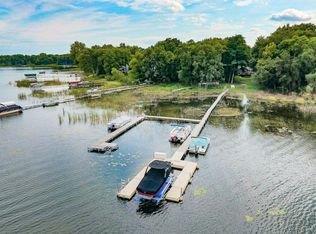
Community Docks 2021
UPDATE 2: Ramsey County considers Homeowners that do NOT own lake front property as easement rights owners. These properties are designated as water rights lots, specifically "WATERRIGHTS LOT", on their website (See Interactive property map - Land Section). The easement rights add assessed value to these properties resulting in additional property tax. It's also means that the easement owner is allowed to use the easement rights to launch a canoe or kayak onto White Bear Lake.

From Interactive Property Map
REF 1: 1983: Original Homeowners' Easement Docks (pdf)
REF 2: Meeting with DNR, WBLCD, and City of White Bear Lake to discuss lake shore questions (pdf)
REF 3: 1991: Experimental Sediment Removal From Cottage Park Bay (pdf)
REF 4: MN DNR Dock General Permit
REF 5: MN DNR Docks Handout